Fort Myers sits on the south bank of the Caloosahatchee River, above the point where the river widens into San Carlos Bay and the Gulf. Anderson Dock & Lift Co. serves Fort Myers from its Bradenton base: the downtown river frontage, the finger canals along the McGregor Boulevard corridor, the Gulf access communities through Iona, and the river shoreline east of the city. The company is veteran owned and operated. Owner Pete Anderson holds Florida certified specialty contractor license SCC131152520, and is a combat veteran with 24 years in the Army and Air Force.
Conditions change over short distances here. A dock on the open river below the Edison Bridge takes wind fetch, current and the wake of everything running the Okeechobee Waterway. A dock at the back of a canal off McGregor Boulevard sits in protected water but deals with silt, limited depth at low water and side lot lines close enough to govern the layout. We set piling depth, deck height and lift capacity for the specific stretch of water in front of the property, and we say so when a shorter dock is the right answer.
The Water in Fort Myers
The Caloosahatchee runs roughly 67 miles to the Gulf and is tidal from LaBelle down, forming an estuary along its lower 25 miles. The W. P. Franklin Lock and Dam at Olga divides the fresh river above from the tidal river below, so every Fort Myers waterfront property sits on the tidal side. The river is also the western leg of the Okeechobee Waterway, which puts through traffic on top of local boats. Billy's Creek and Manuel's Branch drain into it near downtown, and the Orange River joins from the south east of the city near State Road 80. Downstream the river opens into San Carlos Bay, near the Estero Bay, Matlacha Pass and Pine Island Sound aquatic preserves. The NOAA gauge at Fort Myers on the Caloosahatchee River, station 8725520, records a mean range of tide of 0.94 feet and a great diurnal range of 1.32 feet.
Waterfront areas we cover: Town and River, Deep Lagoon, Palmetto Point and Whiskey Creek along the McGregor Boulevard corridor, The Landings, Catalpa Cove, Gulf Harbour and St. Charles Harbour in the Iona area, the downtown Fort Myers river frontage, Billy's Creek, and Fort Myers Shores on the river east of the city.
Docks and Piers Built for the Caloosahatchee and the McGregor Canals
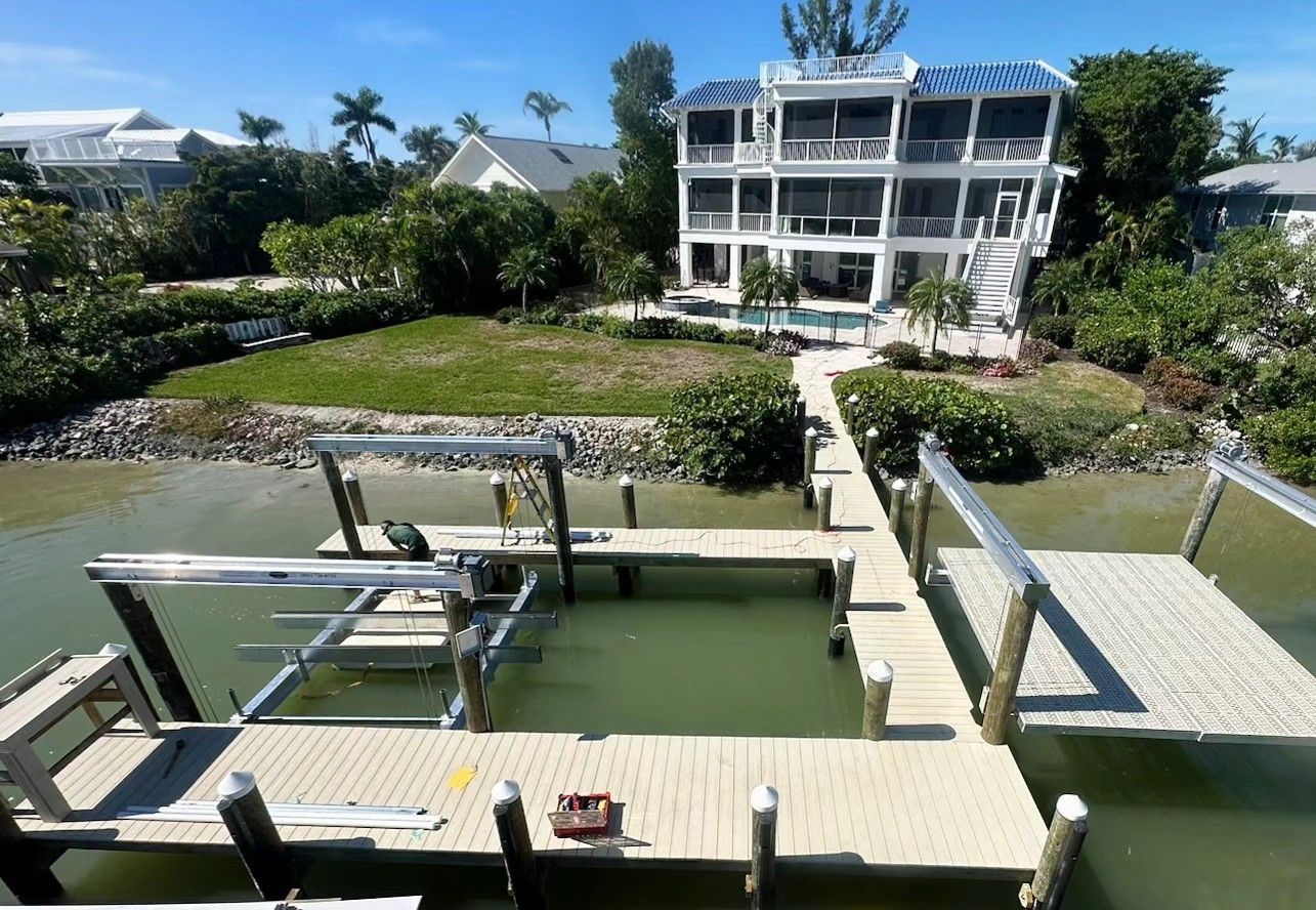
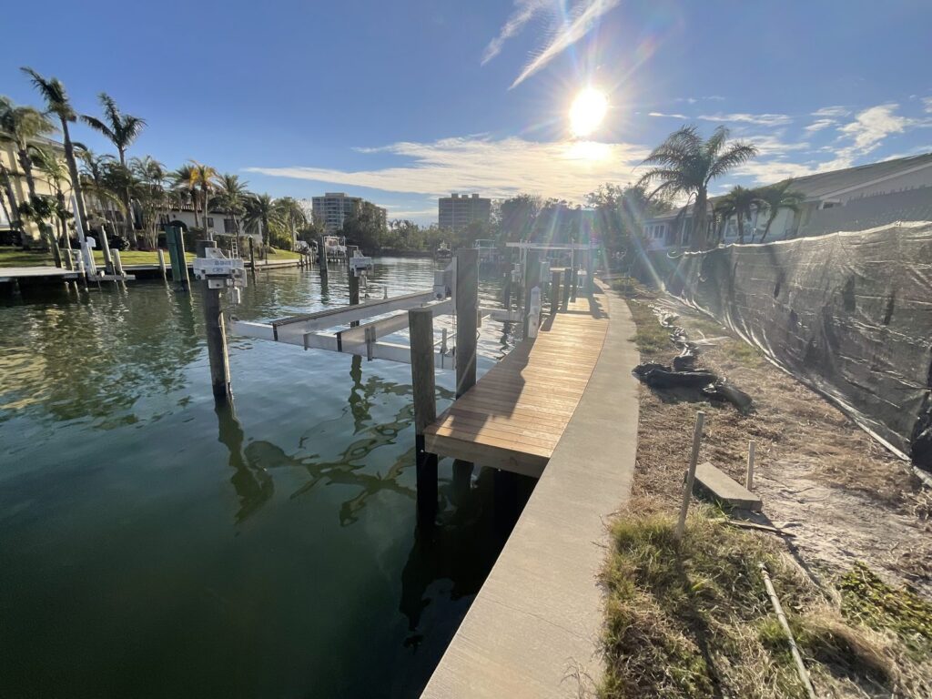
The open river through town is wide and carries both local traffic and boats running the Okeechobee Waterway, so a river dock takes wave energy a canal dock never sees. Piling depth and bracing matter more there than deck square footage. In the finger canals off McGregor Boulevard the problem reverses: protected water, but back ends that silt in and lot lines tight enough that layout becomes the constraint. Because the mean range of tide at the Fort Myers gauge is under a foot, deck elevation has almost no margin to play with. We set it against mean high water and against the freeboard of the boat you actually run. Decking options include Trex, TimberTech AZEK, WearDeck and Deckorators.
Boat Lifts, Canal Depth and the 55 Foot Bridge Line
Lift selection in Fort Myers comes down to depth at low water and what the boat draws. The federal channel is maintained to 10 feet from Fort Myers downstream to Punta Rassa and 8 feet east toward Lake Okeechobee, but those are channel numbers, not what sits at the back of a canal. Because the astronomical range here is less than a foot, wind moves the water level proportionally more than it does where the tide is larger, and a sustained blow can put a hull on the bottom on a day the prediction said it would float. Air draft is the other limit: every fixed bridge over the river in town clears 55 feet, including the Cape Coral Bridge, the Midpoint Memorial Bridge, the Caloosahatchee Bridge on US 41 and the Edison Bridge on US 41 Business. A boat kept upriver of any of them is capped there. We install and service jet ski, pontoon, sailboat and large yacht lifts from Sea Mount, Hurricane and Deco, and we inspect and repair lifts we did not install.
Fort Myers owners can use our hurricane guide for the storm week checklist and the post-storm permit rules.
Seawalls, Tiebacks and Retaining Walls After Ian
Hurricane Ian came ashore at Cayo Costa on September 28, 2022 with 150 mph sustained winds, having reached Category 5 strength over the Gulf, and pushed 12 to 15 feet of surge into Fort Myers Beach, Sanibel and Pine Island. The NOAA gauge at Fort Myers recorded a peak water level of 7.26 feet above mean higher high water, more than double the previous record of 3.41 feet set by Tropical Storm Keith in 1988. The failure pattern on a seawall is usually not the panel face. It is the cap cracking, the tiebacks letting go, and soil washing out through the joints until a void opens under the yard, and none of that has to be visible from the wall itself. We build new seawalls, repair and re-tie existing ones, install and repair retaining walls, and inspect walls before a sale or after a storm.
Inspections, Piling Wraps and Maintenance
With a mean range under a foot, the splash zone on a Fort Myers piling is a narrow band that stays wet nearly all the time. That band is where wood and steel give out first, which is why piling wraps earn their place here. Salinity in front of a Fort Myers property also swings with how much fresh water comes down through the Franklin Lock, so the same piling can see brackish conditions one season and close to fresh water the next. We inspect docks, piers, lifts, seawalls and retaining walls, and we service and repair lifts. A cracked cap, a slipping tieback or a corroded lift cable costs less to fix at the inspection than after it fails.
Permits in Fort Myers
Who issues them: City of Fort Myers Community Development Department, Building, Permitting and Inspections Division at 1825 Hendry Street for addresses inside the city limits, Lee County Community Development Department at 1500 Monroe Street for the unincorporated areas that carry a Fort Myers mailing address, plus the Florida Department of Environmental Protection South District for the environmental resource permit and state owned submerged lands authorization, and the US Army Corps of Engineers, Jacksonville District.
A Fort Myers mailing address does not always mean a City of Fort Myers permit. Much of the canal stock along McGregor Boulevard and out through Iona sits in unincorporated Lee County, so the building permit comes from Lee County Community Development rather than the City's Building, Permitting and Inspections Division. Lee County reviews this work under its dock and shoreline permit, which covers boat lifts, boathouses, davits, fishing piers, seawalls and revetments. Fort Myers Beach is separate again: the Town of Fort Myers Beach permits work on Estero Island, and nearby addresses off the island go back to Lee County. Work over state owned submerged lands goes to the FDEP South District, which covers Lee County from an office in Fort Myers, with the Army Corps of Engineers Jacksonville District reviewing the federal side. Which agencies apply gets settled before the design is final.
What We Build and Repair
Boat Lifts
Boat Lift Service and Repair, Jet Ski Lifts
Learn MoreDocks & Piers
Dock Repair and Maintenance, Piling Wrap Installation
Learn MoreSeawalls
Seawall Repair, Seawall Tieback Installation
Learn MoreRetaining Walls
Retaining Walls
Learn MoreInspections
Waterfront Inspections
Learn MoreCommercial
Commercial Marine Construction
Learn MoreFrequently Asked Questions
How much does the tide move at Fort Myers?
Less than a foot on an average day. The NOAA gauge at Fort Myers on the Caloosahatchee River, station 8725520, publishes a mean range of tide of 0.94 feet and a great diurnal range of 1.32 feet. That leaves very little margin in deck elevation, and it also means wind moves the water level proportionally more than it does where the tide range is larger. A sustained blow can pull water off a canal end on a day the tide table looked fine, so we set lift bunks and cradles against real low water rather than the prediction alone.
What is the air draft limit for a boat kept on the Caloosahatchee at Fort Myers?
Fifty five feet. Every fixed bridge over the river in town has a charted vertical clearance of 55 feet: the Cape Coral Bridge, the Midpoint Memorial Bridge, the Caloosahatchee Bridge carrying US 41 and the Edison Bridge carrying US 41 Business. Downstream, the tallest span of the Sanibel Causeway clears 70 feet at mean high water. If the plan is to run east on the Okeechobee Waterway toward Stuart, the controlling clearance drops again to 49 feet at the Port Mayaca railroad lift bridge. Those numbers cap mast height and tower height for anything kept at a Fort Myers dock.
Who issues dock and seawall permits in Fort Myers?
It depends on which side of the city limit the property sits on. Inside the city, the building permit comes from the City of Fort Myers Community Development Department, Building, Permitting and Inspections Division at 1825 Hendry Street. For unincorporated areas that carry a Fort Myers mailing address, including much of the canal stock along McGregor Boulevard and out through Iona, it comes from the Lee County Community Development Department at 1500 Monroe Street, which handles this work under its dock and shoreline permit. Work over state owned submerged lands also goes to the Florida Department of Environmental Protection South District, which covers Lee County from an office in Fort Myers, and the US Army Corps of Engineers Jacksonville District reviews the federal side. Estero Island is a separate jurisdiction under the Town of Fort Myers Beach.
Could Hurricane Ian have damaged a seawall that still looks intact?
It is worth checking. Ian came ashore at Cayo Costa on September 28, 2022 with 150 mph sustained winds, and the NOAA gauge at Fort Myers recorded a peak water level of 7.26 feet above mean higher high water. The previous record there was 3.41 feet, set by Tropical Storm Keith in 1988. Water that far above normal pulls soil out through panel joints and loads tiebacks past what they were designed for, and the panel face can still look sound while the fill behind it is gone. Watch for a cracking cap, a panel starting to lean, a gap opening at a joint, and low spots or sinkholes in the yard near the wall.
Anderson Dock & Lift is based in Bradenton and works across Florida’s Gulf Coast. See every town we cover, or call (941) 720-6733 for a free estimate within 24 business hours.